SOCIAL ECOLOGICAL CHAIN REACTION IN CENTRAL TEXAS
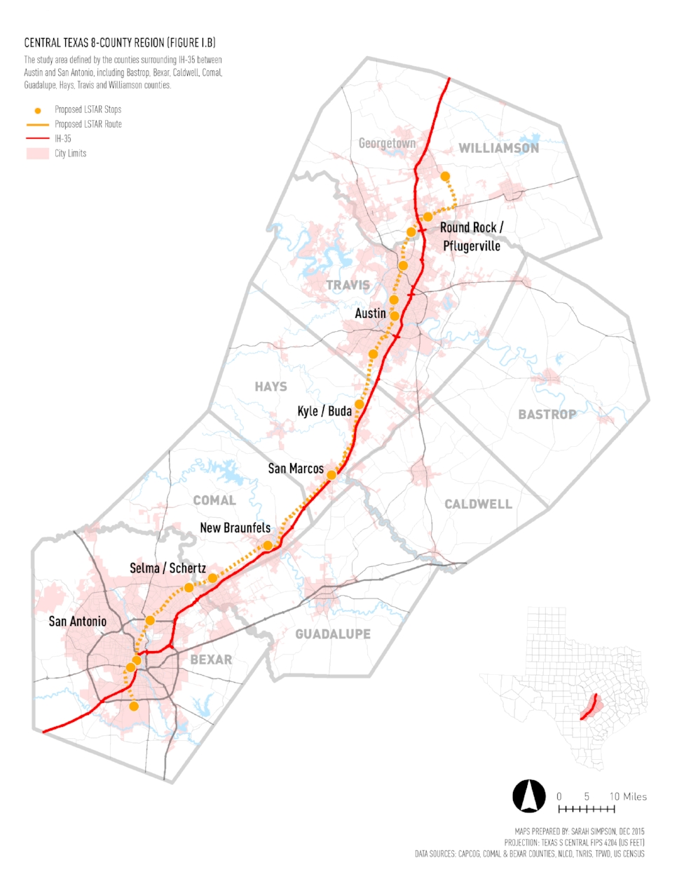
Part of the Texas Triangle mega-region and the Texas Hill Country, the 64-mile Austin - San Antonio corridor is experiencing rapid growth
spurred by a localized tech and industry boom, correlative population growth, and popular acclaim as businesses and individuals alike move
to the area at an unprecedented rate. The region is characterized by heavy private automobile dependence and diffuse, unguided residential
and commercial development that increasingly threatens to destroy the natural assets that so greatly contribute to its attraction.
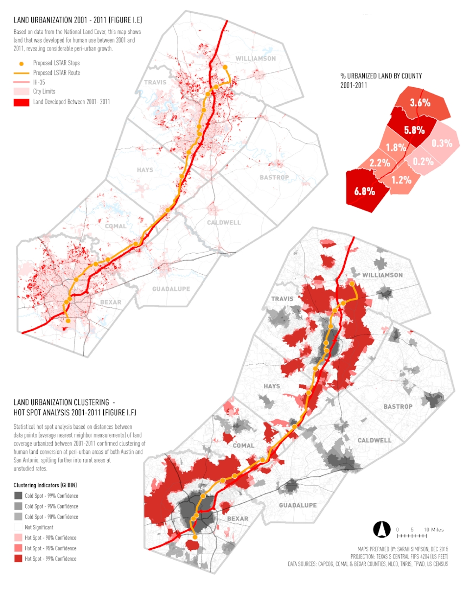
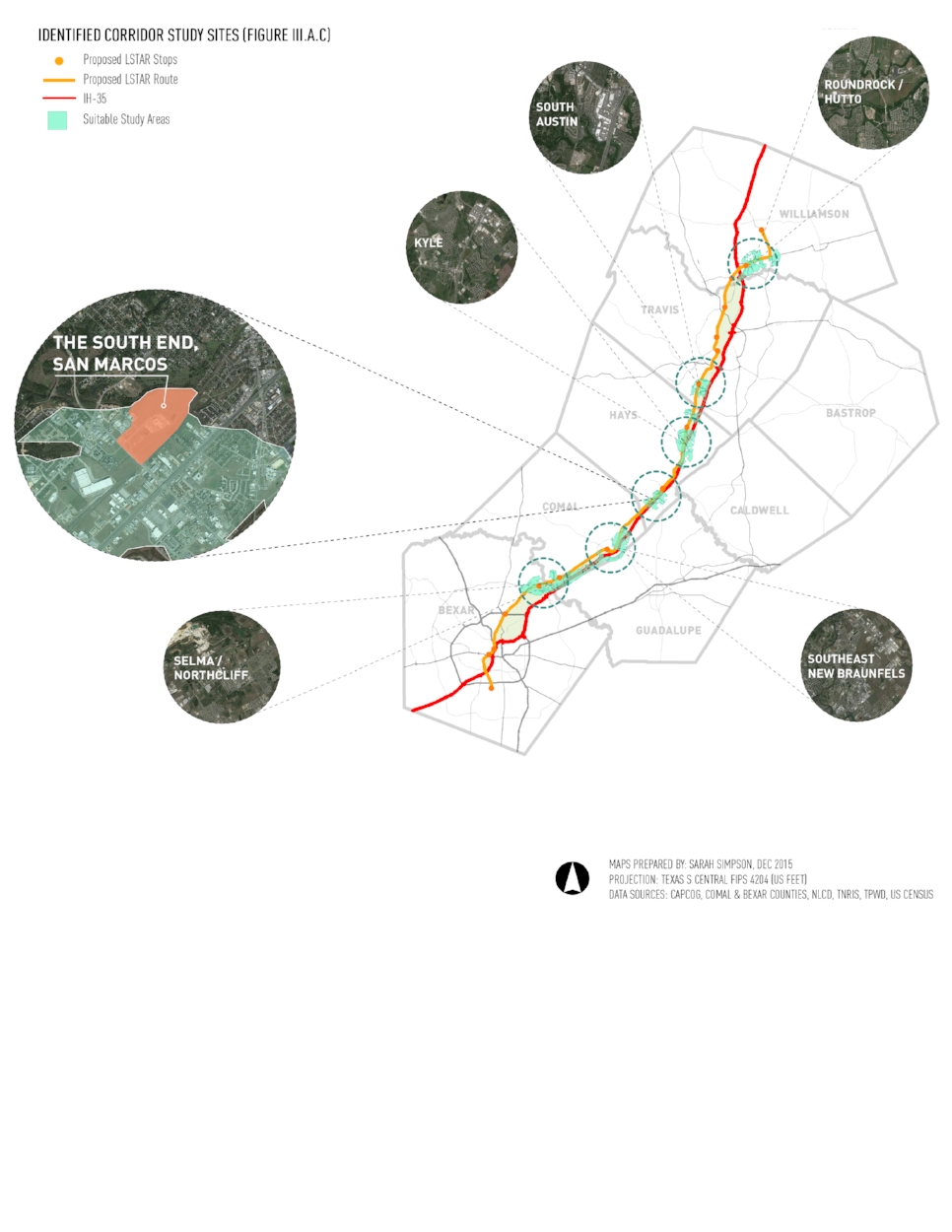
In response to the urban challenges facing central Texas, an initial analysis of land use change intensities throughout the region revealed considerable clustering of urbanization (including both housing and commerce) at the fringes of both major and minor cities with particular consistency along the IH-35 corridor and in proximity to the proposed LSTAR route. While this trend speaks to cheap acquisition of land and limited regulation at the fringes of municipalities, it also highlights a latent potential in the current growth that is slowly building along IH-35 and the LSTAR (Lone Star Rail) proposed route between Austin and San Antonio. As smaller interstitial towns grow within this period of accelerated maturation, there is an opportunity to harness and redirect this conventional momentum to support the creation of sustainable transit networks, as well as environmental conservation, housing and commerce before they expand outwards in a similar fate of San Antonio or Austin. In doing so, there is the possibility to not only slow or prevent long-term erosion of rural lands but also to rebrand the region and change its character.
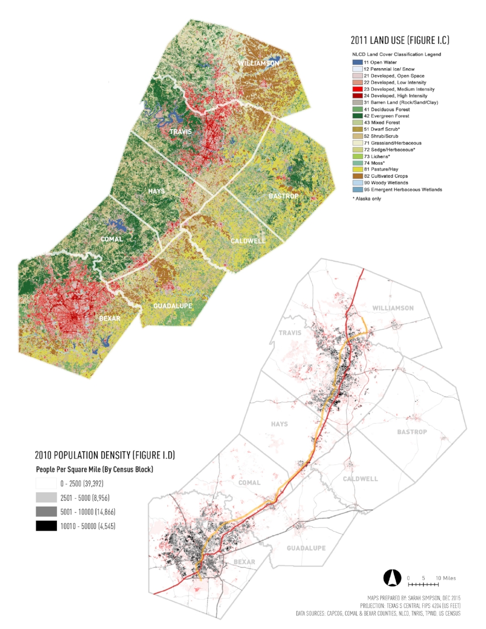
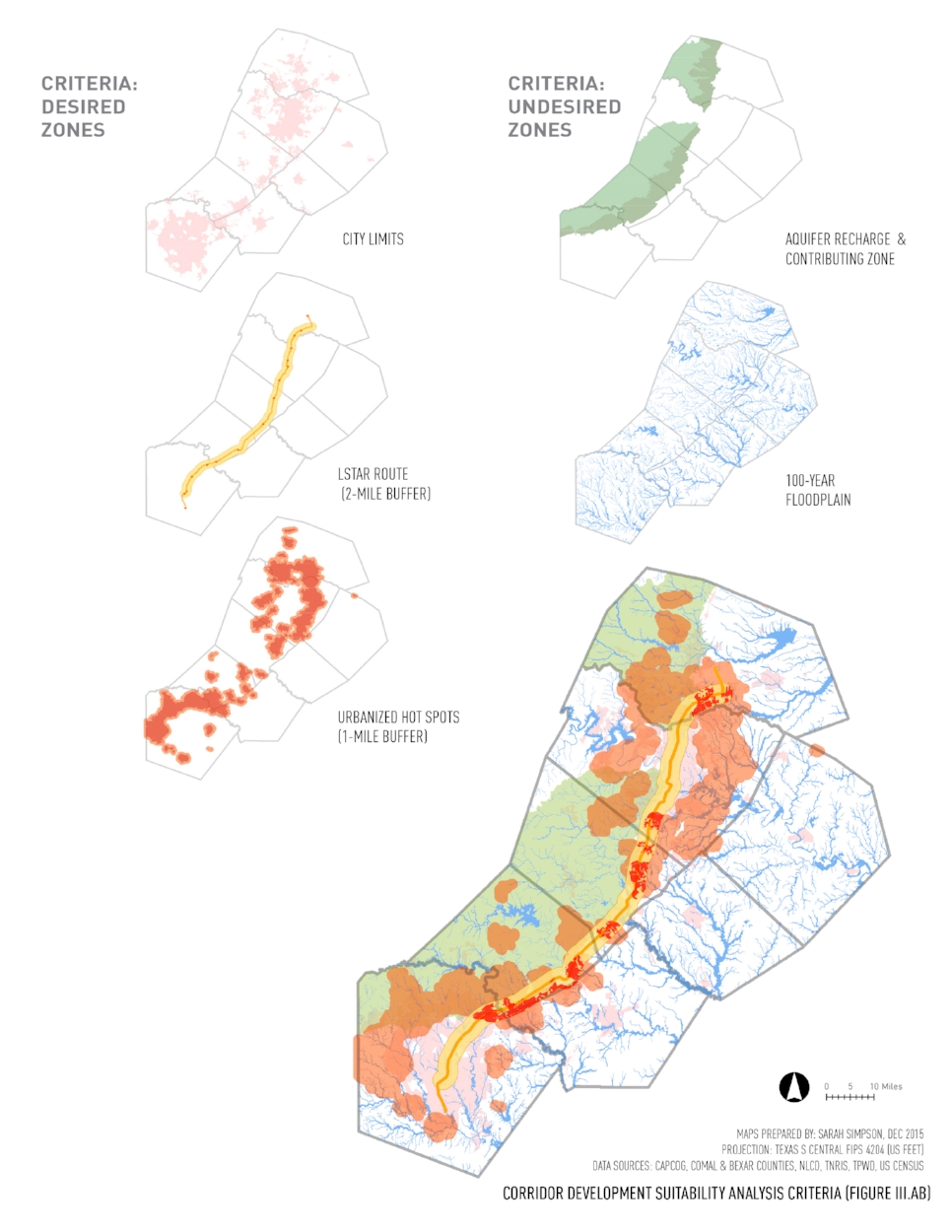
This study of urbanization clustering forms the basis for an accumulative suitability analysis to determine sites linked by regional transit systems for further sustainable, urban design study that also takes into account existing city limits, proximity to planned regional rail, and sensitive lands, such as floodplains and aquifer recharge zones. Six suitability zones emerged from the suitability overlay, all located along the proposed LSTAR route. While each zone requires in-depth property assessment to find specific availability to implement a new sustainable model of growth, these areas all exhibit similar traits of being less intensely developed but bordered by rapid land use change. By investigating areas that may also include natural pieces of land, there is the potential to incorporate natural ecological features and function into urban design, subverting what has historically been the typical modus operandi of clear cutting development sites. And on the other end of the spectrum, in areas that have already been heavily disturbed, there is the possibility at the larger neighborhood or district scale to build frameworks that look to reinvent the ecology of a site and enrich the existing condition.